Google Maps™ Driving Directions (Home) » Glossary » Africa Maps » Page 10

Mali Google Maps

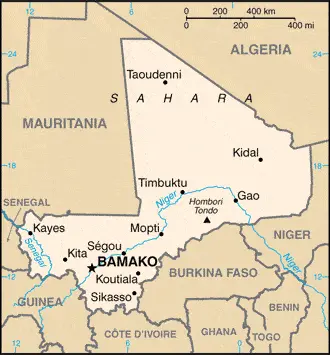
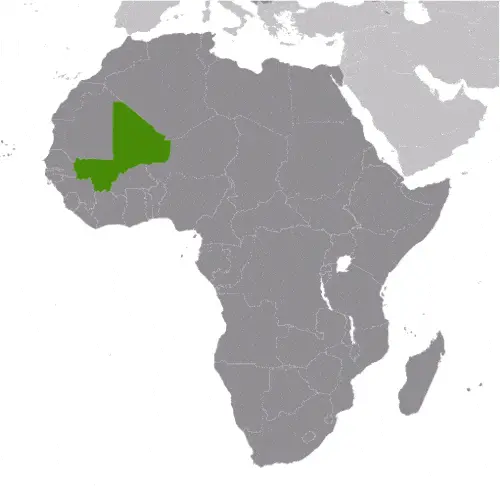
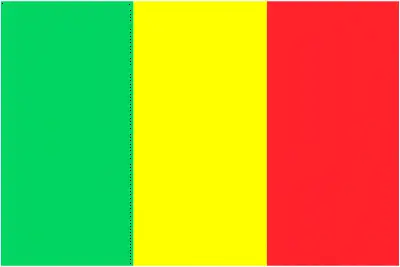
This image shows the draft map of Mali, Africa. For more details of the map of Mali, please see this page below. This image shows the location of Mali, Africa. For more geographical details of Mali, please see this page below. This image shows the flag of Mali, Africa. For more details of the flag of Mali, please see this page below.
Borderline map of Mali Location map of Mali Flag of Mali

Mali Google Maps

Google Maps and Detailed Facts of Mali (ML). This page lets you explore Mali and its border countries (Country Location: interior Western Africa, southwest of Algeria, north of Guinea, Cote d’Ivoire, and Burkina Faso, west of Niger) through detailed Satellite imagery – fast and easy as never before Google Maps.

Find comprehensive information about this country’s diversity below: Google Maps, geography, economy, science, people, culture, environment, government, and history – All in One Wiki page.

There is also a Street View and free Driving Directions at your service. Your Google Satellite Map Sightseeing in Mali, in Africa, starts here at Driving Directions and Maps.com.

Read more

Google Maps™ Driving Directions (Home) » Glossary » Africa Maps » Page 10

Maputo Google Maps

Maputo is one of the most populated cities in Mozambique, and at the same time, this city is the capital of this country. Located in Africa, you may find the city easily with the following GPS coordinates: 25.58S latitude / 32.32E longitude. For routing in Maputo, please check the free driving directions Maputo service below.

Read more

Google Maps™ Driving Directions (Home) » Glossary » Africa Maps » Page 10

Maseru Google Maps

Maseru is one of the most populated cities in Lesotho, and at the same time, this city is the capital of this country. Located in Africa, you may find the city easily with the following GPS coordinates: 29.18S latitude / 27.30E longitude. For routing in Maseru, please check the free driving directions Maseru service below.

Read more

Google Maps™ Driving Directions (Home) » Glossary » Africa Maps » Page 10

Mauritania

Driving Directions Mauritania

MAURITANIA is near twice the size of France. Located on the west coast of Africa, almost the whole country lies within the sandy, stony wastes of the Sahara Desert. The only settlements in this area are around oases, where a little millet, dates, and vegetables can be grown.

There are dry Sahel grasslands in the south and a fertile agricultural land belt along the northern side of the Senegal river valley.

Read more

Google Maps™ Driving Directions (Home) » Glossary » Africa Maps » Page 10

Mauritania Google Maps

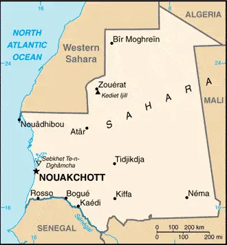
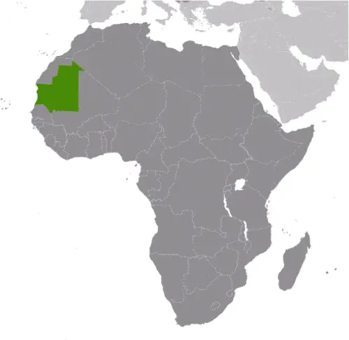
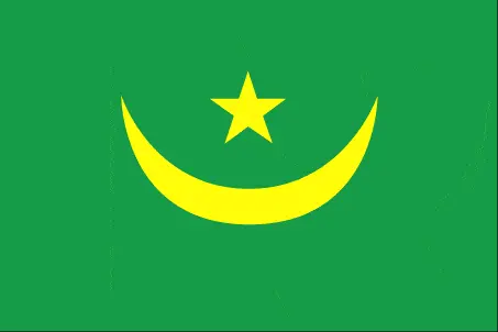
This image shows the draft map of Mauritania, Africa. For more details of the map of Mauritania, please see this page below. This image shows the location of Mauritania, Africa. For more geographical details of Mauritania, please see this page below. This image shows the flag of Mauritania, Africa. For more details of the flag of Mauritania, please see this page below.
Borderline map of Mauritania Location map of Mauritania Flag of Mauritania

Mauritania Google Maps

Google Maps and Detailed Facts of Mauritania (MR). This page lets you explore Mauritania and its border countries (Country Location: Western Africa, bordering the North Atlantic Ocean, between Senegal and Western Sahara) through detailed Satellite imagery – fast and easy as never before Google Maps.

Find comprehensive information about this country’s diversity below: Google Maps, geography, economy, science, people, culture, environment, government, and history – All in One Wiki page.

There is also a Street View and free Driving Directions at your service. Your Google Satellite Map Sightseeing in Mauritania, in Africa, starts here at Driving Directions and Maps.com.
Read more

Google Maps™ Driving Directions (Home) » Glossary » Africa Maps » Page 10

Mauritius

Driving Directions Mauritius

MAURITIUS is a beautiful island republic that lies in the Indian Ocean some 800 kilometers or 497 miles east of Madagascar. The islands of Rodrigues and Agalega are also part of Mauritius.

Mauritius is a volcanic island with many craters surrounded by lava flows. The central plateau rises to over 800 meters or 2,625 feet, then drops sharply to the south and west coasts.

Read more

Google Maps™ Driving Directions (Home) » Glossary » Africa Maps » Page 10

Mauritius Google Maps

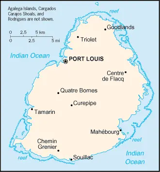
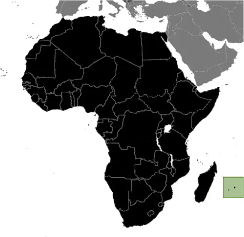
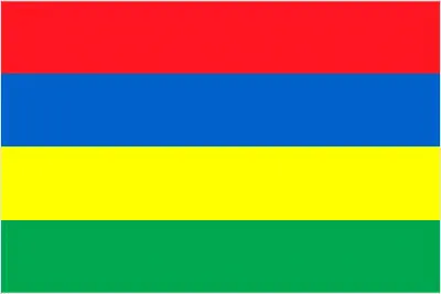
This image shows the draft map of Mauritius, Africa. For more details of the map of Mauritius, please see this page below. This image shows the location of Mauritius, Africa. For more geographical details of Mauritius, please see this page below. This image shows the flag of Mauritius, Africa. For more details of the flag of Mauritius, please see this page below.
Borderline map of Mauritius Location map of Mauritius Flag of Mauritius

Mauritius Google Maps

Google Maps and Detailed Facts of Mauritius (MU). This page lets you explore Mauritius and its border countries (Country Location: Southern Africa, an island in the Indian Ocean, about 800 km (500 mi) east of Madagascar) through detailed Satellite imagery – fast and easy as never before Google Maps.

Find comprehensive information about this country’s diversity below: Google Maps, geography, economy, science, people, culture, environment, government, and history – All in One Wiki page.

There is also a Street View and free Driving Directions at your service. Your Google Satellite Map Sightseeing in Mauritius, in Africa, starts here at Driving Directions and Maps.com.
Read more

Google Maps™ Driving Directions (Home) » Glossary » Africa Maps » Page 10

Mbabane Google Maps

Mbabane is one of the most populated cities in Swaziland, and at the same time, this city is the capital of this country. Located in Africa, you may find the city easily with the following GPS coordinates: 26.18S latitude / 31.06E longitude. For routing in Mbabane, please check the free driving directions Mbabane service below.

Read more

Google Maps™ Driving Directions (Home) » Glossary » Africa Maps » Page 10

Mogadishu Google Maps

Mogadishu is one of the most populated cities in Somalia, and at the same time, this city is the capital of this country. Located in Africa, you may find the city easily with the following GPS coordinates: 02.02N latitude / 45.25E longitude. For routing in Mogadishu, please check the free driving directions Mogadishu service below.

Read more

Google Maps™ Driving Directions (Home) » Glossary » Africa Maps » Page 10

Monrovia Google Maps

Monrovia is one of the most populated cities in Liberia, and at the same time, this city is the capital of this country. Located in Africa, you may find the city easily with the following GPS coordinates: 06.18N latitude / 10.47W longitude. For routing in Monrovia, please check the free driving directions Monrovia service below.

Read more