Google Maps™ Driving Directions (Home) » Glossary » Africa Maps » Page 11

Morocco

Driving Directions Morocco

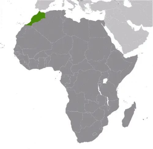
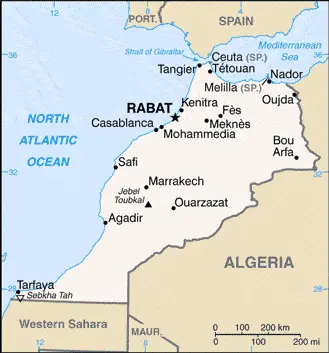
MOROCCO, in northwest Africa, is strategically placed at the western entrance to the Mediterranean Sea. Morocco lays claim to the territory of Western Sahara while Spain administers the ports of Melilla and Ceuta.

It is a country of diverse topography, climate, and human history whose ancient cities of Tanger, Fes, Marrakech, and Casablanca have long held a fascination for Europeans.

Read more

Google Maps™ Driving Directions (Home) » Glossary » Africa Maps » Page 11

Morocco Google Maps

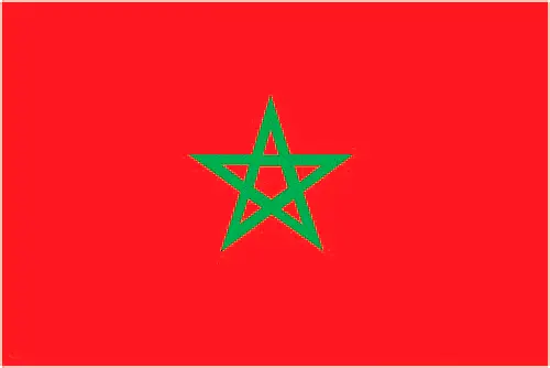
This image shows the draft map of Morocco, Africa. For more details of the map of Morocco, please see this page below. This image shows the location of Morocco, Africa. For more geographical details of Morocco, please see this page below. This image shows the flag of Morocco, Africa. For more details of the flag of Morocco, please see this page below.
Borderline map of Morocco Location map of Morocco Flag of Morocco

Morocco Google Maps

Google Maps and Detailed Facts of Morocco (MA). This page lets you explore Morocco and its border countries (Country Location: Northern Africa, bordering the North Atlantic Ocean and the Mediterranean Sea, between Algeria and Western Sahara) through detailed Satellite imagery – fast and easy as never before Google Maps.

Find comprehensive information about this country’s diversity below: Google Maps, geography, economy, science, people, culture, environment, government, and history – All in One Wiki page.

There is also a Street View and free Driving Directions at your service. Your Google Satellite Map Sightseeing in Morocco, in Africa, starts here at Driving Directions and Maps.com.

Read more

Google Maps™ Driving Directions (Home) » Glossary » Africa Maps » Page 11

Moroni Google Maps

Moroni is one of the most populated cities in Comoros, and at the same time, this city is the capital of this country. Located in Africa, you may find the city easily with the following GPS coordinates: 11.40S latitude / 43.16E longitude. For routing in Moroni, please check the free driving directions Moroni service below.

Read more

Google Maps™ Driving Directions (Home) » Glossary » Africa Maps » Page 11

Mozambique

Driving Directions Mozambique

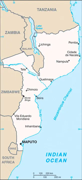
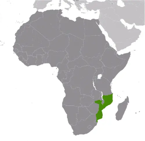
MOZAMBIQUE is a republic located in southeast Africa. It lies on the east coast of Africa, facing Madagascar’s island across the Mozambique Channel with Tanzania to the north, Malawi, Zambia, and Zimbabwe to the west, and South Africa and Swaziland to the south and southwest.

Lagoons, islands, and reefs fringe the coastline of approximately 2,500 kilometres or 1,552 miles.

Read more

Google Maps™ Driving Directions (Home) » Glossary » Africa Maps » Page 11

Mozambique Google Maps

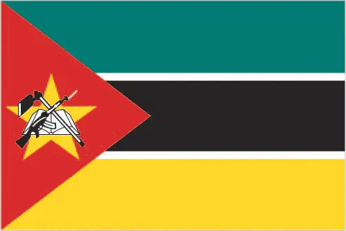
This image shows the draft map of Mozambique, Africa. For more details of the map of Mozambique, please see this page below. This image shows the location of Mozambique, Africa. For more geographical details of Mozambique, please see this page below. This image shows the flag of Mozambique, Africa. For more details of the flag of Mozambique, please see this page below.
Borderline map of Mozambique Location map of Mozambique Flag of Mozambique

Mozambique Google Maps

Google Maps and Detailed Facts of Mozambique (MZ). This page lets you explore Mozambique and its border countries (Country Location: Southeastern Africa, bordering the Mozambique Channel, between South Africa and Tanzania) through detailed Satellite imagery – fast and easy as never before Google Maps.

Find comprehensive information about this country’s diversity below: Google Maps, geography, economy, science, people, culture, environment, government, and history – All in One Wiki page.

There is also a Street View and free Driving Directions at your service. Your Google Satellite Map Sightseeing in Mozambique, in Africa, starts here at Driving Directions and Maps.com.

Read more

Google Maps™ Driving Directions (Home) » Glossary » Africa Maps » Page 11

N’Djamena Google Maps

N’Djamena is one of the most populated cities in Chad, and at the same time, this city is the capital of this country. Located in Africa, you may find the city easily with the following GPS coordinates: 12.10N latitude / 14.59E longitude. For routing in N’Djamena, please check the free driving directions N’Djamena service below.

Read more

Google Maps™ Driving Directions (Home) » Glossary » Africa Maps » Page 11

Nairobi Google Maps

Nairobi is one of the most populated cities in Kenya, and at the same time, this city is the capital of this country. Located in Africa, you may find the city easily with the following GPS coordinates: 01.17S latitude / 36.48E longitude. For routing in Nairobi, please check the free driving directions Nairobi service below.

Read more

Google Maps™ Driving Directions (Home) » Glossary » Africa Maps » Page 11

Namibia Google Maps

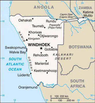
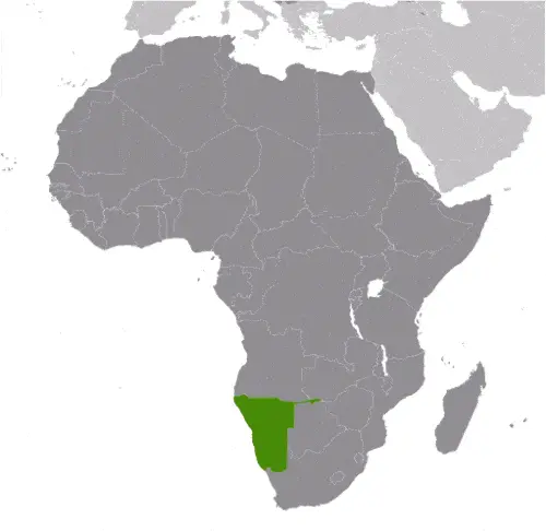
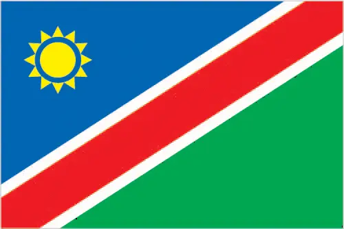
This image shows the draft map of Namibia, Africa. For more details of the map of Namibia, please see this page below. This image shows the location of Namibia, Africa. For more geographical details of Namibia, please see this page below. This image shows the flag of Namibia, Africa. For more details of the flag of Namibia, please see this page below.
Borderline map of Namibia Location map of Namibia Flag of Namibia

Namibia Google Maps

Google Maps and Detailed Facts of Namibia (NA). This page lets you explore Namibia and its border countries (Country Location: Southern Africa, bordering the South Atlantic Ocean, between Angola and South Africa) through detailed Satellite imagery – fast and easy as never before Google Maps.

Find comprehensive information about this country’s diversity below: Google Maps, geography, economy, science, people, culture, environment, government, and history – All in One Wiki page.

There is also a Street View and free Driving Directions at your service. Your Google Satellite Map Sightseeing in Namibia, in Africa, starts here at Driving Directions and Maps.com.

Read more

Google Maps™ Driving Directions (Home) » Glossary » Africa Maps » Page 11

Niamey Google Maps

Niamey is one of the most populated cities in Niger, and at the same time, this city is the capital of this country. Located in Africa, you may find the city easily with the following GPS coordinates: 13.27N latitude / 02.06E longitude. For routing in Niamey, please check the free driving directions Niamey service below.

Read more