Google Maps™ Driving Directions (Home) » Glossary » Asia Maps » Page 10

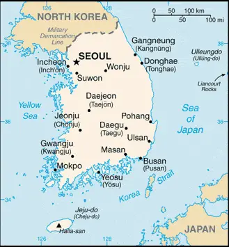
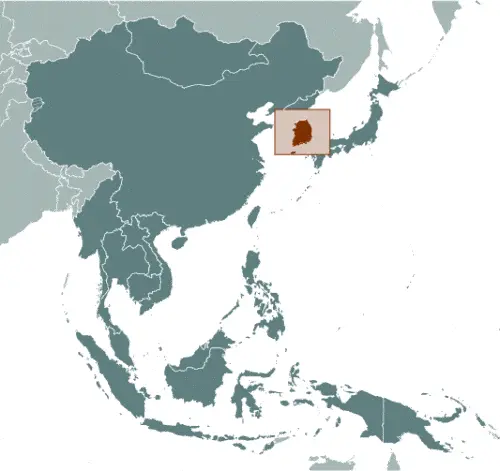
South Korea Google Maps

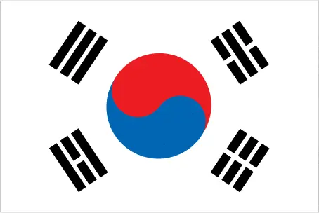
This image shows the draft map of Korea South, Asia. For more details of the map of Korea South, please see this page below. This image shows the location of Korea South, Asia. For more geographical details of Korea South, please see this page below. This image shows the flag of Korea South, Asia. For more details of the flag of Korea South, please see this page below.
Borderline map of Korea South Location map of Korea South Flag of Korea South

South Korea Google Maps

Google Maps and Detailed Facts of Korea South (KR). This page lets you explore Korea South and its border countries (Country Location: Eastern Asia, the southern half of the Korean Peninsula bordering the Sea of Japan and the Yellow Sea) through detailed Satellite imagery – fast and easy as never before Google Maps.

Find comprehensive information about this country’s diversity below: Google Maps, geography, economy, science, people, culture, environment, government, and history – All in One Wiki page.

There is also a Street View and free Driving Directions at your service. Your Google Satellite Map Sightseeing in Korea South, in Asia, starts here at Driving Directions and Maps.com.

Read more

Google Maps™ Driving Directions (Home) » Glossary » Asia Maps » Page 10

Sri Lanka

Driving Directions Sri Lanka

SRI LANKA is an island republic lying in the Indian Ocean just off India’s southeastern tip, from which separated by the Palk Strait.

Until 1948, when it achieved independence, it was under British rule and called Ceylon. The shallow Palk Strait is interrupted by a chain of reefs and islands known as Adam’s Bridge, which almost links the two coasts. The island is dominated by a central, southern mass of hills and mountains (rising to a maximum height of 2,524 meters or 8,281 feet), surrounded by lower coastal plains.

Read more

Google Maps™ Driving Directions (Home) » Glossary » Asia Maps » Page 10

Sri Lanka Google Maps

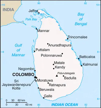
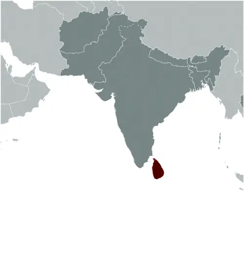
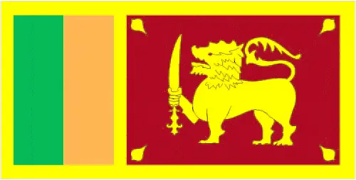
This image shows the draft map of Sri Lanka, Asia. For more details of the map of Sri Lanka, please see this page below. This image shows the location of Sri Lanka, Asia. For more geographical details of Sri Lanka, please see this page below. This image shows the flag of Sri Lanka, Asia. For more details of the flag of Sri Lanka, please see this page below.
Borderline map of Sri Lanka Location map of Sri Lanka Flag of Sri Lanka

Sri Lanka Google Maps

Google Maps and Detailed Facts of Sri Lanka (CE). This page lets you explore Sri Lanka and its border countries (Country Location: Southern Asia, an island in the Indian Ocean, south of India) through detailed Satellite imagery – fast and easy as never before Google Maps.

Find comprehensive information about this country’s diversity below: Google Maps, geography, economy, science, people, culture, environment, government, and history – All in One Wiki page.

There is also a Street View and free Driving Directions at your service. Your Google Satellite Map Sightseeing in Sri Lanka, in Asia, starts here at Driving Directions and Maps.com.
Read more

Google Maps™ Driving Directions (Home) » Glossary » Asia Maps » Page 10

Syria

Driving Directions Syria

SYRIA is a country in southwest Asia which borders the Mediterranean Sea in the west. Much of the country consists of arid plateau lands and plains, which grade into the southeast desert.

There is a narrow, fer­tile coastal plain alongside the Mediterranean shore, but this soon gives way to a belt of hills running north to south, which rises to form the high­er Anti-Lebanon Mountains extending across the border with Lebanon. The River Euphrates enters the country from Turkey in the northwest and flows southeastwards into Iraq. In contrast, a second major river, the Orontes, flows northwards from the Anti-Lebanon Mountains across western Syria.

Read more

Google Maps™ Driving Directions (Home) » Glossary » Asia Maps » Page 10

Taipei Google Maps

Taipei is one of the most populated cities in Taiwan, and at the same time, this city is the capital of this country. Located in Asia, you may find the city easily with the following GPS coordinates: 25.03N latitude / 121.56E longitude. For routing in Taipei, please check the free driving directions Taipei service below.

Read more

Google Maps™ Driving Directions (Home) » Glossary » Asia Maps » Page 10

Taiwan

Driving Directions Taiwan

TAIWAN was formerly known to the West by its Portuguese name of Formosa, “Beautiful Island.” It is the largest group of islands located in the Pacific Ocean, about 161-kilo­meters or 100 miles off mainland China’s southeast coast, across the Taiwan Strait.

Taiwan’s independence, resulting from the island’s seizure by nationalists in 1949, is not entirely accepted internationally, and China lays claim to the territory. An additional 78 islands make up Taiwan province, including those called the Pescadores (“Fishermen’s Islands”) by the Portuguese but known as Penghu to the Chinese. Other islands, such as Quemoy (Jinmen) and Maju, lie closer to the coast of the main­land.

Read more

Google Maps™ Driving Directions (Home) » Glossary » Asia Maps » Page 10

Tajikistan

Driving Directions Tajikistan

TAJIKISTAN is a republic of the former USSR, which declared itself | independent in 1991. China bounds this central Asian country in the east, Afghanistan to the south, Uzbekistan to the west, and Kyrgyzstan to the north. It also includes the autonomous region of Gorno-Badakh Shan.

Read more

Google Maps™ Driving Directions (Home) » Glossary » Asia Maps » Page 10

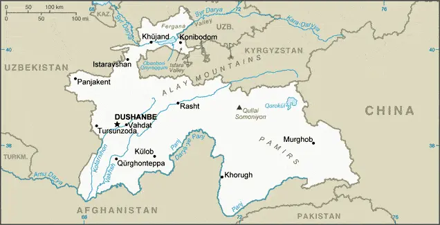
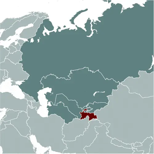
Tajikistan Google Maps

This image shows the draft map of Tajikistan, Asia. For more details of the map of Tajikistan, please see this page below. This image shows the location of Tajikistan, Asia. For more geographical details of Tajikistan, please see this page below. This image shows the flag of Tajikistan, Asia. For more details of the flag of Tajikistan, please see this page below.
Borderline map of Tajikistan Location map of Tajikistan Flag of Tajikistan

Tajikistan Google Maps

Google Maps and Detailed Facts of Tajikistan (TJ). This page lets you explore Tajikistan and its border countries (Country Location: Central Asia, west of China, south of Kyrgyzstan) through detailed Satellite imagery – fast and easy as never before Google Maps.

Find comprehensive information about this country’s diversity below: Google Maps, geography, economy, science, people, culture, environment, government, and history – All in One Wiki page.

There is also a Street View and free Driving Directions at your service. Your Google Satellite Map Sightseeing in Tajikistan, in Asia, starts here at Driving Directions and Maps.com.
Read more

Google Maps™ Driving Directions (Home) » Glossary » Asia Maps » Page 10

Tashkent Google Maps

Tashkent is one of the most populated cities in Uzbekistan, and at the same time, this city is the capital of this country. Located in Asia, you may find the city easily with the following GPS coordinates: 41.20N latitude / 69.10E longitude. For routing in Tashkent, please check the free driving directions Tashkent service below.

Read more

Google Maps™ Driving Directions (Home) » Glossary » Asia Maps » Page 10

Tbilisi Google Maps

Tbilisi is one of the most populated cities in Georgia, and at the same time, this city is the capital of this country. Located in Asia, you may find the city easily with the following GPS coordinates: 41.43N latitude / 44.50E longitude. For routing in Tbilisi, please check the free driving directions Tbilisi service below.

Read more