Damascus is one of the most populated cities in Syria, and at the same time, this city is the capital of this country. Located in Asia, you may find the city easily with the following GPS coordinates: 33.30N latitude / 36.18E longitude. For routing in Damascus, please check the free driving directions Damascus service below.
Asia Maps
Explore the countries in Asia with all their Wiki, find information on weather, population, facts, history, landmarks of major cities data, and enjoy free Google maps Satellite imagery & Street views. Each Country Profile in Asia provides information on Geography data, area maps, Google maps, flag, history, area, population, the capital city, largest cities, economy, spoken languages, ethnicity/race, religion, literacy rate, government, and many more!
In this map category, you will find these Asian countries and their capital cities:
Afghanistan, Armenia, Azerbaijan, Bahrain, Bangladesh, Bhutan, Brunei, Cambodia, China, Cyprus, East Timor, Georgia, India, Indonesia, Iran, Iraq, Israel, Japan, Jordan, Kazakhstan, Kuwait, Kyrgyzstan, Laos, Lebanon, Malaysia, Mongolia, Myanmar, Nepal, North Korea, Oman, Pakistan, Philippines, Qatar, Russia, Saudi Arabia, Singapore, South Korea, Sri Lanka, Syria, Taiwan, Tajikistan, Thailand, Turkey, Turkmenistan, United Arab Emirates, Uzbekistan, Vietnam, Yemen.
Dhaka Google Maps
Dhaka is one of the most populated cities in Bangladesh, and at the same time, this city is the capital of this country. Located in Asia, you may find the city easily with the following GPS coordinates: 23.43N latitude / 90.26E longitude. For routing in Dhaka, please check the free driving directions Dhaka service below.
Doha Google Maps
Doha is one of the most populated cities in Qatar, and at the same time, this city is the capital of this country. Located in Asia, you may find the city easily with the following GPS coordinates: 25.15N latitude / 51.35E longitude. For routing in Doha, please check the free driving directions Doha service below.
Dushanbe Google Maps
Dushanbe is one of the most populated cities in Tajikistan, and at the same time, this city is the capital of this country. Located in Asia, you may find the city easily with the following GPS coordinates: 38.33N latitude / 68.48E longitude. For routing in Dushanbe, please check the free driving directions Dushanbe service below.
East Jerusalem Google Maps
East Jerusalem is one of the most populated cities in Palestine, and at the same time, this city is the capital of this country. Located in Asia, you may find the city easily with the following GPS coordinates: 31.46N latitude / 35.13E longitude. For routing in East Jerusalem, please check the free driving directions East Jerusalem service below.
Georgia
Driving Directions Georgia
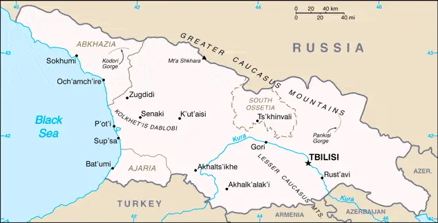
GEORGIA, a republic in the southwest of the former USSR, gained full independence from Russia in 1991. It shares borders with Turkey, Armenia, Azerbaijan, and the Russian Federation and is bounded to the west by the Black Sea. The country incorporates the breakaway republic of Abkhazia and the semi-autonomous regions of Adzharia and South Ossetia. It consists of a coastal plain and low-lying river valleys sandwiched between two high mountain ranges – the Great Caucasus in the north and the Lesser Caucasus in the south.
The climate on the coast is moist and warm, while inland, it is dry, with hot summers and cold winters. Glaciers and snowfields occur on the highest peaks of the Caucasus Mountains. About one-third of the country is forested, with conifers on the mountain slopes and deciduous species lower down. Wildlife includes deer, lynx, wolf, wild boar, and eagle.
Georgia Google Maps
 |
 |
 |
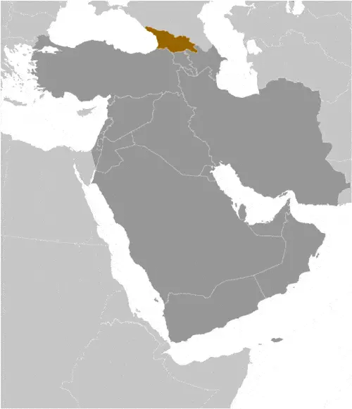
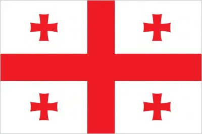
| Borderline map of Georgia | Location map of Georgia | Flag of Georgia |
Google Maps and Detailed Facts of Georgia (GE). This page lets you explore Georgia and its border countries (Country Location: Southwestern Asia, bordering the Black Sea, between Turkey and Russia, with a sliver of land north of the Caucasus extending into Europe; note – Georgia views itself as part of Europe; geopolitically, it can be classified as falling within Europe, the Middle East, or both) through detailed Satellite imagery – fast and easy as never before Google Maps.
Find comprehensive information about this country’s diversity below: Google Maps, geography, economy, science, people, culture, environment, government, and history – All in One Wiki page.
There is also a Street View and free Driving Directions at your service. Your Google Satellite Map Sightseeing in Georgia, in Asia, starts here at Driving Directions and Maps.com.
Hanoi Google Maps
Hanoi is one of the most populated cities in Vietnam, and at the same time, this city is the capital of this country. Located in Asia, you may find the city easily with the following GPS coordinates: 21.05N latitude / 105.55E longitude. For routing in Hanoi, please check the free driving directions Hanoi service below.
Hong Kong
Driving Directions Hong Kong
HONG KONG is a Special Autonomous Province of China. It is located in the South China Sea and consists of Hong Kong Island (once a barren rock), the peninsula of Kowloon, and about 1,000 square kilometers or 386 square miles of adjacent land known as the New Territories.
Hong Kong situated at the mouth of the Pearl River about 130 kilometers or 81 miles southeast of Guangzhou (Canton).
India
Driving Directions India
INDIA is a vast republic in South Asia dominated in the extreme north by the world’s youngest and highest mountains, the Himalayas. The diverse Republic of India encompasses a wide variety of geographical features and human societies. It is the second-most densely populated country globally and is home to one in six of the world’s population, many of whom live in extreme poverty conditions.
The northeastern states, including Assam, are effectively cut off from India, connected only by a narrow corridor of land squeezed between Nepal and Bangladesh’s borders.
The country has three main geographical divisions: the high peaks of the Himalayas which dominate the northern border; the densely populated, fertile northern plains which are drained by the Ganges and Brahmaputra rivers; and the ancient Deccan Plateau region to the south, which extends to the southern tip of the country.
