Google Maps™ driving directions home » North America maps

Bermuda

Driving Directions Bermuda

BERMUDA consists of a group of 150 small islands in the western Atlantic Ocean. It lies about 920 kilometers or 572 miles east of Cape Hatteras on the coast of the USA. The hilly limestone islands are the caps of ancient volcanoes rising from the sea bed. The main island, Great Bermuda, is linked to the other islands by bridges and causeways.

Read more

Google Maps™ driving directions home » North America maps

Bermuda Google Map

Google Maps and Detailed Facts of Bermuda (BM). This page lets you explore Bermuda and its border countries (Country Location: North America, group of islands in the North Atlantic Ocean, east of South Carolina (US)) through detailed Satellite imagery – fast and easy as never before Google Maps.

Find comprehensive information about this country’s diversity below: Google maps, geography, economy, science, people, culture, environment, government, and history – All in One Wiki page.

There is also a Street View and free Driving Directions at your service. Your Google Satellite Map Sightseeing in Bermuda starts at Driving Directions and Maps.com in North America.

Read more

Google Maps™ driving directions home » North America maps

Canada

Driving Directions Canada

CANADA is the second-largest country in the world and the largest in North America. Canada is a land of great climatic and geographical extremes. It lies to the north of the USA and has Pacific, Atlantic, and Arctic coasts. The country has the highest number of inland waters and lakes globally, including the Great Lakes on the border with the USA. The Rocky Mountains and Coast Mountains run down the west side, and the highest point, Mount Logan (6,050 meters or 19,524 feet), is in the Yukon. Climates range from polar conditions in the north to cool tem­perate in the south with considerable differences from west to east.

Read more

Google Maps™ driving directions home » North America maps

Canada Google Map

Google Maps and Detailed Facts of Canada (CA). This page lets you explore Canada and its border countries (Country Location: Northern North America, bordering the North Atlantic Ocean on the east, North Pacific Ocean on the west, and the Arctic Ocean on the north, north of the conterminous US) through detailed Satellite imagery – fast and easy as never before Google Maps.

Find comprehensive information about this country’s diversity below: Google maps, geography, economy, science, people, culture, environment, government, and history – All in One Wiki page.

There is also a Street View and free Driving Directions at your service. Your Google Satellite Map Sightseeing in Canada in North America, starts here at Driving Directions and Maps.com.

Read more

Google Maps™ driving directions home » North America maps

Mexico Google Map

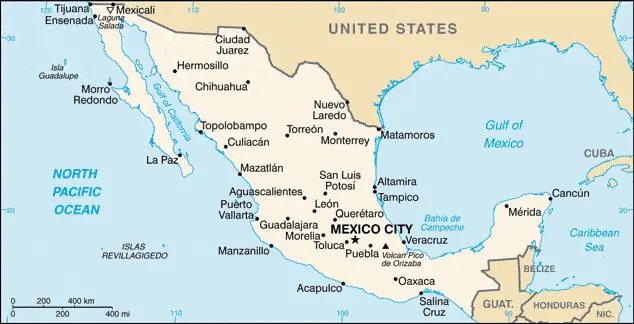
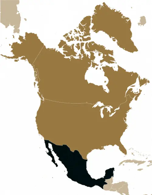
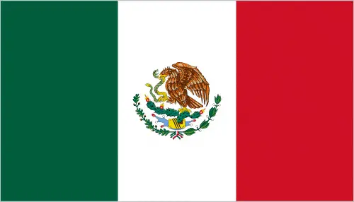
This image shows the draft map of Mexico, North America. For more details of the map of Mexico, please see this page below. This image shows the location of Mexico, North America. For more geographical details of Mexico, please see this page below. This image shows the flag of Mexico, North America. For more details of the flag of Mexico, please see this page below.
Borderline map of Mexico Location map of Mexico Flag of Mexico

Mexico Google map

Google Maps and Detailed Facts of Mexico (MX). This page lets you explore Mexico and its border countries (Country Location: North America, bordering the Caribbean Sea and the Gulf of Mexico, between Belize and the United States and bordering the North Pacific Ocean, between Guatemala and the United States) through detailed Satellite imagery – fast and easy as never before Google Maps.

Find comprehensive information about this country’s diversity below: Google maps, geography, economy, science, people, culture, environment, government, and history – All in One Wiki page.

There is also a Street View and free Driving Directions at your service. Your Google Satellite Map Sightseeing in Mexico, in North America, starts here at Driving Directions and Maps.com.

Read more

Google Maps™ driving directions home » North America maps

North America

North America is the world’s third-largest continent, with a total area of 9,358,340 sq miles (24,238,000 sq km), including Greenland and the Caribbean islands. North America lies entirely within the Northern Hemisphere.

Area: 9,358,340 sq miles (24,238,000 sq km).
The highest point is Mount McKinley (Denali), USA, which is 20,332 ft (6194 m).
The lowest point is Death Valley, USA, which is -282 ft (-86 m) below sea level.
The longest river is Mississippi-Missouri, USA, 3710 miles (5969 km).
The largest lake is Lake Superior, Canada/USA, which is 31,151 sq miles (83,270 sq km).
The largest island is Greenland, which is 849,400 sq miles (2,200,000 sq km).
The highest recorded temperature is Death Valley, USA, at 135°F (57 °C).
The lowest recorded temperature was Northice, Greenland -87°F (-66°C).
The wettest place is Vancouver, Canada, at 183 in (4645 mm).
The driest place is Death Valley, USA, at 2 in (50 mm).
Population: approximately 579,490,000 people.
The number of countries: 23.

Read more

Google Maps™ driving directions home » North America maps

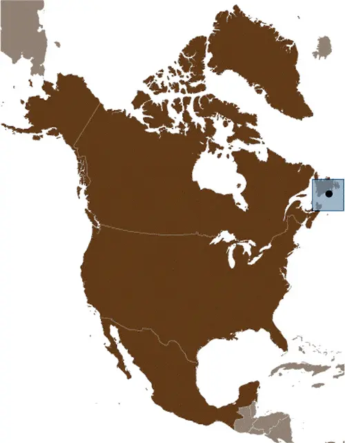
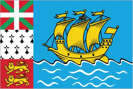
Saint Pierre and Miquelon Google Map

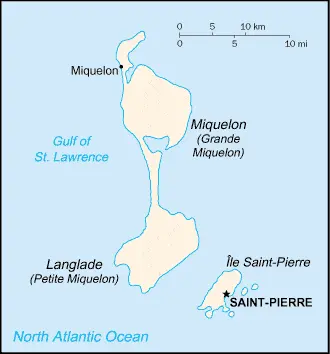
This image shows the draft map of Saint Pierre and Miquelon, North America. For more details of the map of Saint Pierre and Miquelon, please see this page below. This image shows the location of Saint Pierre and Miquelon, North America. For more geographical details of Saint Pierre and Miquelon, please see this page below. This image shows the flag of Saint Pierre and Miquelon, North America. For more details of the flag of Saint Pierre and Miquelon, please see this page below.
Borderline map of Saint Pierre and Miquelon Location map of Saint Pierre and Miquelon Flag of Saint Pierre and Miquelon

Saint Pierre and Miquelon Google map

Google Maps and Detailed Facts of Saint Pierre and Miquelon (PM). This page lets you explore Saint Pierre and Miquelon and its border countries (Country Location: Northern North America, islands in the North Atlantic Ocean, south of Newfoundland (Canada)) through detailed Satellite imagery – fast and easy as never before Google Maps.

Find comprehensive information about this country’s diversity below: Google maps, geography, economy, science, people, culture, environment, government, and history – All in One Wiki page.

There is also a Street View and free Driving Directions at your service. Your Google Satellite Map Sightseeing in Saint Pierre and Miquelon, in North America, starts here at Driving Directions and Maps.com.

Read more

Google Maps™ driving directions home » North America maps

The United States (USA) Google Map

The United States (USA) Google map

Google Maps and detailed facts about the United States (US). This page lets you explore the United States (USA) and its border countries (Country Location: North America, bordering both the North Atlantic Ocean and the North Pacific Ocean, between Canada and Mexico) through detailed Satellite imagery – fast and easy as never before Google Maps.

Find comprehensive information about this country’s diversity below: Google maps, geography, economy, science, people, culture, environment, government, and history – All in One Wiki page.

There is also a Street View and free Driving Directions at your service. Your Google Satellite Map Sightseeing in the United States (USA) in North America starts here at Driving Directions and Maps.com.

Read more

Google Maps™ driving directions home » North America maps

United States of America (USA)

Driving Directions United States of America (USA)

THE UNITED STATES OF AMERICA (USA) is the fourth-largest country in the world. It stretches across north-central America, from the Atlantic Ocean in the east to the Pacific Ocean in the west and from Canada in the north to Mexico and the Gulf of Mexico in the south.

The world’s most developed nation, the USA, consists of fifty states, includ­ing outlying Alaska, northwest of Canada, and Hawaii in the Pacific Ocean. Two high mountain ranges dominate the country, the Rocky Mountains in the west and the Appalachian Mountains in the east. Between them lie the Great Plains – fertile, flatlands crossed by many rivers. The largest of these rivers is the Mississippi, and together with its main tributary, Missouri, it is the third-longest river in the world. The Great Lakes (Superior, Michigan, Huron, and Erie) in the northeast form part of Canada’s border.

Read more