Google Maps™ Driving Directions (Home) » Glossary » South America Maps

Argentina

Driving Directions Argentina

ARGENTINA, the world’s eighth-largest country, stretches from the Tropic of Capricorn to Cape Horn on the southern tip of the South American continent. It is 3,331 kilometers or 2,070 miles long and nowhere exceeds 1,384 kilometers or 860 miles in width, and it also includes the eastern part of Tierra del Fuego.

Read more

Google Maps™ Driving Directions (Home) » Glossary » South America Maps

Argentina Google Maps

Google Maps and Detailed Facts of Argentina (AR). This page lets you explore Argentina and its border countries (Country Location: Southern South America, bordering the South Atlantic Ocean, Chile, and Uruguay) through detailed Satellite imagery – fast and easy as never before Google Maps.

Find comprehensive information about this country’s diversity below: Google Maps, geography, economy, science, people, culture, environment, government, and history – All in One Wiki page.

There is also a Street View and free Driving Directions at your service. Your Google Satellite Map Sightseeing in Argentina, in South America, starts here at Driving Directions and Maps.com.

Read more

Google Maps™ Driving Directions (Home) » Glossary » South America Maps

Bolivia

Driving Directions Bolivia

BOLIVIA is one of only two South American countries surround­ed by land on all sides, having lost its Pacific coastline to Peru and Chile in the late 1800s. The dominant topographical feature is the Andes mountain chain. This forms two main ranges, the Cordillera Occidental and the Cordillera Oriental running from north to south in the southwest­ern third of the country. Lying in between them is a high, fairly barren, treeless plateau called the Altiplano, where most Bolivians live. Lake Titicaca, which straddles the border with Peru, is in the northern part of the Altiplano. The country’s administrative capital and largest city, La Paz, lies just to the south and the east of Lake Titicaca and is the high­est capital city in the world, built 3,612 meters or 11,850 feet above sea level.

Read more

Google Maps™ Driving Directions (Home) » Glossary » South America Maps

Bolivia Google Maps

Google Maps and Detailed Facts of Bolivia (BO). This page lets you explore Bolivia and its border countries (Country Location: Central South America, southwest of Brazil) through detailed Satellite imagery – fast and easy as never before Google Maps.

Find comprehensive information about this country’s diversity below: Google Maps, geography, economy, science, people, culture, environment, government, and history – All in One Wiki page.

There is also a Street View and free Driving Directions at your service. Your Google Satellite Map Sightseeing in Bolivia, in South America, starts here at Driving Directions and Maps.com.

Read more

Google Maps™ Driving Directions (Home) » Glossary » South America Maps

Brazil

Driving Directions Brazil

BRAZIL is a huge South American country bounded to the north, south, and east by the Atlantic Ocean. It is the fifth-largest country in the world and covers nearly half of South America. There are two dominant topographical features – the great Amazon river basin and the ancient plateau region of crystalline rocks called the Brazilian Highlands. The Amazon river basin occupies a huge land area, over one-third of the country’s area, and much of this covered with tropical rainforests.

Read more

Google Maps™ Driving Directions (Home) » Glossary » South America Maps

Brazil Google Maps

Google Maps and Detailed Facts of Brazil (BR). This page lets you explore Brazil and its border countries (Country Location: Eastern South America, bordering the Atlantic Ocean) through detailed Satellite imagery – fast and easy as never before Google Maps.

Find comprehensive information about this country’s diversity below: Google Maps, geography, economy, science, people, culture, environment, government, and history – All in One Wiki page.

There is also a Street View and free Driving Directions at your service. Your Google Satellite Map Sightseeing in Brazil and South America starts at Driving Directions and Maps.com.

Read more

Google Maps™ Driving Directions (Home) » Glossary » South America Maps

Chile

Driving Directions Chile

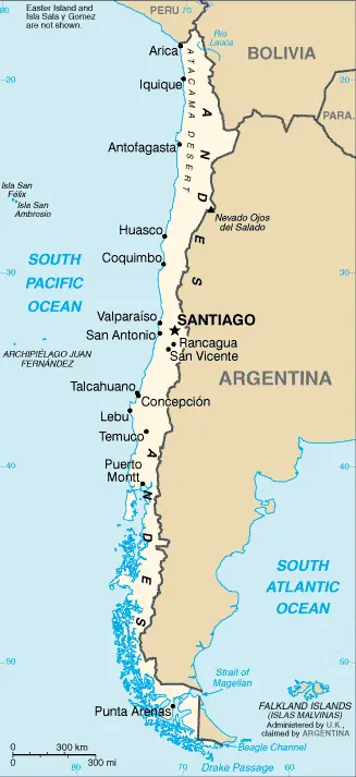
CHILE lies like a backbone down the Pacific coast of the South American continent. It extends from Peru in the north right down to Cape Horn on Tierra del Fuego’s southern tip, a total length from north to south of about 4,184 kilometers or 2,600 miles. At its widest point, Chile does not exceed 185 kilometers or 115 miles. The country experiences volcanic explosions and earthquakes.

Read more

Google Maps™ Driving Directions (Home) » Glossary » South America Maps

Chile Google Maps

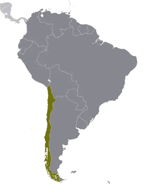
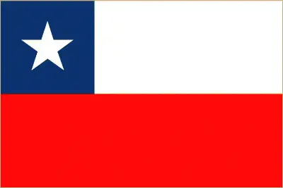
This image shows the draft map of Chile, South America. For more details of the map of Chile, please see this page below. This image shows the location of Chile, South America. For more geographical details of Chile, please see this page below. This image shows the flag of Chile, South America. For more details of the flag of Chile, please see this page below.
Borderline map of Chile Location map of Chile Flag of Chile

Chile Google Maps

Google Maps and Detailed Facts of Chile (CI). This page lets you explore Chile and its border countries (Country Location: Southern South America, bordering the South Pacific Ocean, Argentina, and Peru) through detailed Satellite imagery – fast and easy as never before Google Maps.

Find comprehensive information about this country’s diversity below: Google Maps, geography, economy, science, people, culture, environment, government, and history – All in One Wiki page.

There is also a Street View and free Driving Directions at your service. Your Google Satellite Map Sightseeing in Chile, in South America, starts here at Driving Directions and Maps.com.

Read more

Google Maps™ Driving Directions (Home) » Glossary » South America Maps

Colombia

Driving Directions Colombia

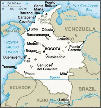
COLOMBIA is situated in the north of South America, and most of the country lies between the equator and 10°N. The Andes Mountains are split into three ranges in Colombia: the Cordillera Occidental, the Cordillera Central, and the Cordillera Oriental. The most westerly range is the Cordillera Occidental, which consists of fairly low but rugged foothills that rise behind the Pacific coast. On the east side of these, the River Cauca flows from south to north, joining with Colombia’s main river, the Magdalena, 322 kilometers or 200 miles south of the Caribbean coast. Rising on the eastern side of the Cauca valley, the Cordillera Central’s high peaks attain more than 5,029 meters or 16,500 feet, and many are active volcanoes. On the far side of these lies the great Magdalena river, running northwards for a distance of over 15,289-kilo­meters or 9,500 miles, which is nearly the entire length of the country. To the east again are found the Andean range of the Cordillera Oriental, a region of plateaux, plains, peaks, and lakes.

Read more

Google Maps™ Driving Directions (Home) » Glossary » South America Maps

Colombia Google Maps

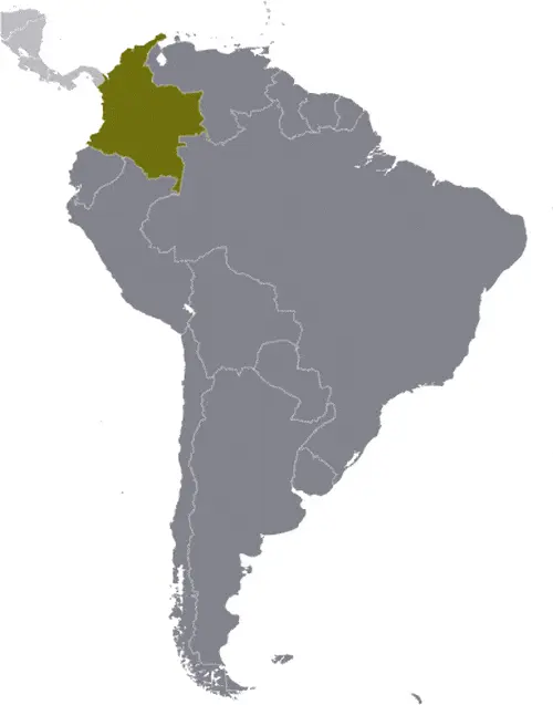
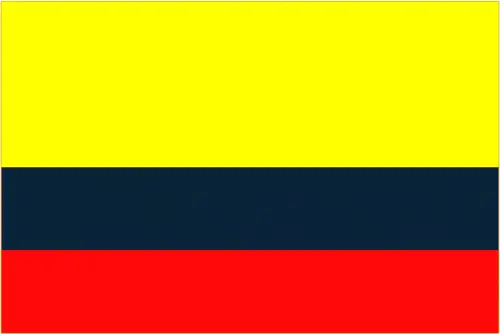
This image shows the draft map of Colombia, South America. For more details of the map of Colombia, please see this page below. This image shows the location of Colombia, South America. For more geographical details of Colombia, please see this page below. This image shows the flag of Colombia, South America. For more details of the flag of Colombia, please see this page below.
Borderline map of Colombia Location map of Colombia Flag of Colombia

Colombia Google Maps

Google Maps and Detailed Facts of Colombia (CO). This page lets you explore Colombia and its border countries (Country Location: Northern South America, bordering the Caribbean Sea, between Panama and Venezuela, and bordering the North Pacific Ocean, between Ecuador and Panama) through detailed Satellite imagery – fast and easy as never before Google Maps.

Find comprehensive information about this country’s diversity below: Google Maps, geography, economy, science, people, culture, environment, government, and history – All in One Wiki page.

There is also a Street View and free Driving Directions at your service. Your Google Satellite Map Sightseeing in Colombia, in South America, starts here at Driving Directions and Maps.com.

Read more