Google Maps™ Driving Directions (Home) » Glossary » Greece

Greece

Driving Directions Greece

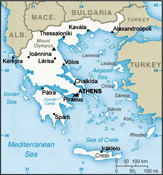
GREECE or the Hellenic Republic consists of a mainland portion and more than 1,400 islands. Mainland Greece occupies the southernmost portion of the Balkans Peninsula and shares borders with Albania in the northwest, with Macedonia (FYROM) and Bulgaria in the north, and Turkey in the northeast. The Aegean Sea lies to the east, the Mediterranean Sea to the south, and the Ionian Sea to the west.

The Ionian Islands (lonioi Nisoi), including Corfu (Kerkira), lie off the western mainland coast in the Ionian Sea. The remaining Greek islands scattered throughout the Aegean Sea. They include the Cyclades (Kikladhes) group in the southeast, Crete (Kriti) in the south, the Dodecanese group (Dhodhekanisos), including Rhodes (Rodhos), just west of mainland Turkey, the northern Aegean Islands, such a Thásos, Limnos, and Lésvós, and the Northern Sporades (Voriai Sporhadhes), situated off the eastern coast of Greece. In general, the islands are quite arid, hilly, and stony, with thin soils that are difficult to cultivate.

Read more

Google Maps™ Driving Directions (Home) » Glossary » Greece

Athens Google Maps

Athens is one of the most populated cities in Greece, and at the same time, this city is the capital of this country. Located in Europe, you may find the city easily with the following GPS coordinates: 37.58N latitude / 23.46E longitude. For routing in Athens, please check the free driving directions Athens service below.

Read more

Google Maps™ Driving Directions (Home) » Glossary » Greece

The most Googled products in each country in Europe

Just like earlier, today, in our popular culture, most countries are stereotypically associated with certain products or services. Probably you also would think of Germany regarding beer or Mercedes, carpets of Turkey, electronics of Japan, or pizza of Italy.

Read more

Google Maps™ Driving Directions (Home) » Glossary » Greece

Greece Google Maps

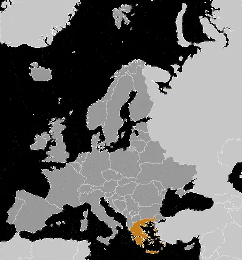
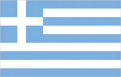
This image shows the draft map of Greece, Europe. For more details of the map of Greece, please see this page below. This image shows the location of Greece, Europe. For more geographical details of Greece, please see this page below. This image shows the flag of Greece, Europe. For more details of the flag of Greece, please see this page below.
Borderline map of Greece Location map of Greece Flag of Greece

Greece Google Maps

Google Maps and Detailed Facts of Greece (GR). This page lets you explore Greece and its border countries (Country Location: Southern Europe, bordering the Aegean Sea, Ionian Sea, and the Mediterranean Sea, between Albania and Turkey) through detailed Satellite imagery – fast and easy as never before Google Maps.

Find comprehensive information about this country’s diversity below: Google Maps, geography, economy, science, people, culture, environment, government, and history – All in One Wiki page.

There is also a Street View and free Driving Directions at your service. Your Google Satellite Map Sightseeing in Greece, in Europe, starts here at Driving Directions and Maps.com.

Read more

Google Maps™ Driving Directions (Home) » Glossary » Greece

Culinary Map of Europe According to Greece 2015

Europe has always been a continent known in the Culinary world for its many wonderful cuisines. From the many exotic Italian dishes to the many aesthetic delicacies originating from Spain, Europe is a continent that excels in Culinary diversity.

Not all European countries are known for their Culinary genius, however, and to differentiate these “disappointments” from the Culinary aristocracy of Europe, many tourists have had to use Culinary maps that point out which countries have great foods and which ones are well… disappointments.

Read more