Google Maps™ Driving Directions (Home) » Glossary » Swaziland

Africa

Africa is the world’s second-largest continent, with a total area of 11,712,434 sq miles (30,335,000 sq km). It has 54 separate countries, including Madagascar, in the Indian Ocean. It straddles the equator and is the only continent to stretch from the northern to southern temperate zones.

Area: 11,633,846 sq miles (30,131,536 sq km).
The highest point is Mt. Kilimanjaro, Tanzania, which is 19,341 ft (5,895 m).
The lowest Point is Lac ‘Assal, Djibouti, -512 ft (-156 m) below sea level.
The longest river is the Nile, Egypt/Sudan/Uganda, which is 4,187 miles (6,738 km).
The largest lake is L. Victoria, Tanzania/Uganda/Kenya, which is 26,828 sq miles (69,484 sq km).
The largest island is Madagascar, which is 226,660 sq miles (587,040 sq km).
The highest recorded temperature in Al’Aziziyah, Libya, is 136°F (58 °C).
The lowest recorded temperature is in Ifrane, Morocco, at 11°F (-24 °C).
The wettest place is Cape Debundsha, Cameroon, at 405 in (10,290 mm).
The driest Place is Wadi Halfa, Sudan <0.1 in (<2.5 mm).
Population: approximately 849,000,000 people.
The number of countries: 53.

Read more

Google Maps™ Driving Directions (Home) » Glossary » Swaziland

Swaziland

Driving Directions Swaziland

SWAZILAND is a landlocked hilly country almost entirely within the Republic of South Africa’s borders but with a short border in the east with Mozambique. The mountains in the west of the country rise to almost 2,000 meters or 6,562 feet, then descend in savanna steps toward the hilly country in the east.

Read more

Google Maps™ Driving Directions (Home) » Glossary » Swaziland

Mbabane Google Maps

Mbabane is one of the most populated cities in Swaziland, and at the same time, this city is the capital of this country. Located in Africa, you may find the city easily with the following GPS coordinates: 26.18S latitude / 31.06E longitude. For routing in Mbabane, please check the free driving directions Mbabane service below.

Read more

Google Maps™ Driving Directions (Home) » Glossary » Swaziland

Swaziland Google Maps

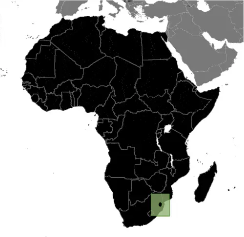
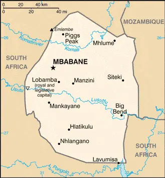
This image shows the draft map of Swaziland, Africa. For more details of the map of Swaziland, please see this page below. This image shows the location of Swaziland, Africa. For more geographical details of Swaziland, please see this page below. This image shows the flag of Swaziland, Africa. For more details of the flag of Swaziland, please see this page below.
Borderline map of Swaziland Location map of Swaziland Flag of Swaziland

Swaziland Google Maps

Google Maps and Detailed Facts of Swaziland (SZ). This page lets you explore Swaziland and its border countries (Country Location: Southern Africa, between Mozambique and South Africa) through detailed Satellite imagery – fast and easy as never before Google Maps.

Find comprehensive information about this country’s diversity below: Google Maps, geography, economy, science, people, culture, environment, government, and history – All in One Wiki page.

There is also a Street View and free Driving Directions at your service. Your Google Satellite Map Sightseeing in Swaziland, in Africa, starts here at Driving Directions and Maps.com.

Read more